Home > Local history > Ireland > Kilrea > Letts’s map 1883, enlarged
Enlarged view of Letts’s map (extract) of county Londonderry & surrounding areas, highlighting the mid-eastern section of the county, depicting towns and villages in the counties of London:Derry and Antrim alongside the river Bann:
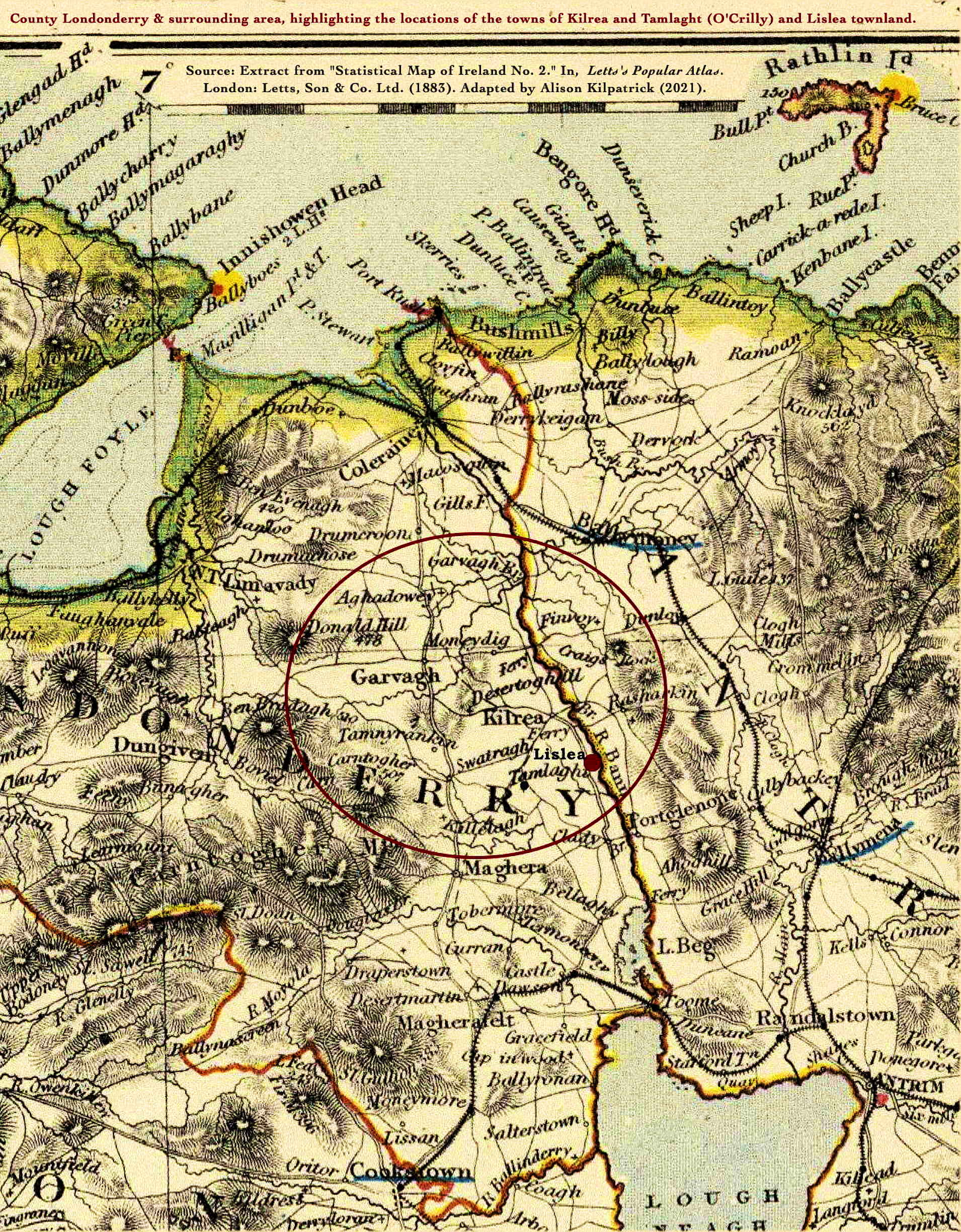
See the referring page, Letts’s map (1883) of Kilrea, Lislea, & Tamlaght, county Derry for a description of the map, a list of towns and parishes, and the scale of the map.
Source:
Letts & Co. Ltd. Extract from “Statistical Map of Ireland. No. 2.” In, Letts’s Popular Atlas, being a series of maps delineating the whole surface of the globe, with many special and original features; and a copious index of 23,000 names. Complete edition. London: Letts Son & Co. Limited, 33, King William Street, London Bridge, E.C. Factory and works at New Cross, S.E. 1883. Online at David Rumsey’s Map Collection ![]() . Adapted by Alison Kilpatrick (2021).
. Adapted by Alison Kilpatrick (2021).
End notes :
Source citation for this page: Arborealis. “Lett’s map 1883 (2) of Kilrea, Lislea, and Tamlaght, County Derry (enlarged).” Online at Arborealis, arborealis.ca/local-history/ireland/kilrea/letts-1883-enlarged/, accessed [insert date].
All rights reserved. Alison Kilpatrick ©2021.
Added 29th Dec. 2023.