Home > Local history > Ireland > Claremorris & Kilcolman > Map of Connaught or Connacht, 1823
End notes :
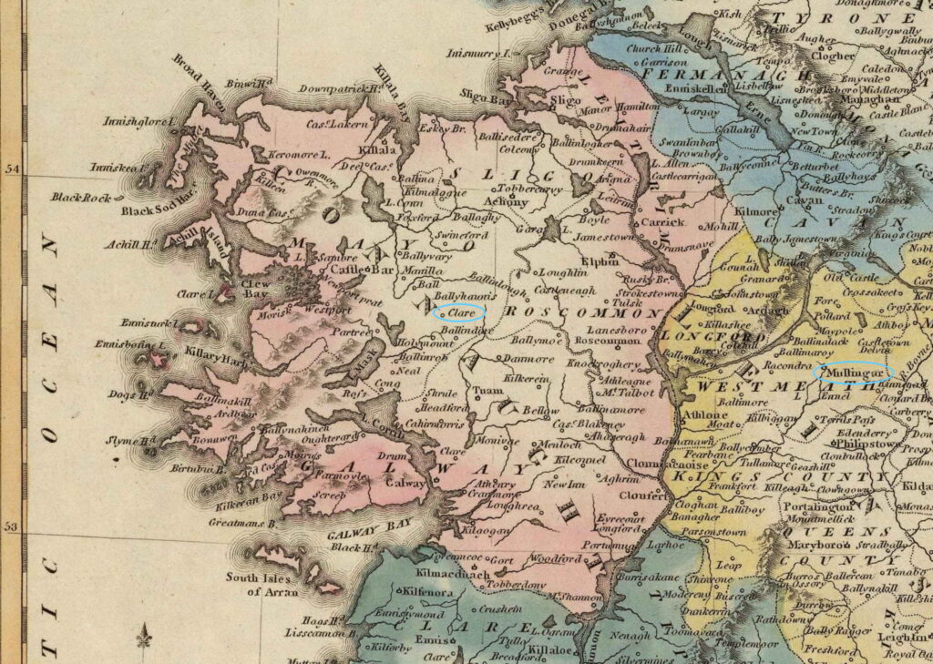
Source citation for this page: Arborealis. “Map of the Province of Connaught (Connacht), 1823,” published by Jos. Perkins (Baltimore: Lucas, Fielding Jr., 1823). Edited by Alison Kilpatrick. Published to Arborealis, online at arborealis.ca/local-history/ireland/kilcolman/map-connaught-1823/, accessed [insert date].
All rights reserved. Alison Kilpatrick ©2021. Reproduction or sharing of this page is not permitted.
Re-use of the map, as edited, is permitted not-for-profit purposes, only. Inclusion of the map in any work is subject to providing attribution (credit to the transcriber) with an appropriate source citation (as shown in the “Source citation for this page,” above), and a link back to Arborealis, as per our Ethical use and Appeal for common courtesy statements.
Page added 5th Oct. 2023; edited 28th Dec. 2023.