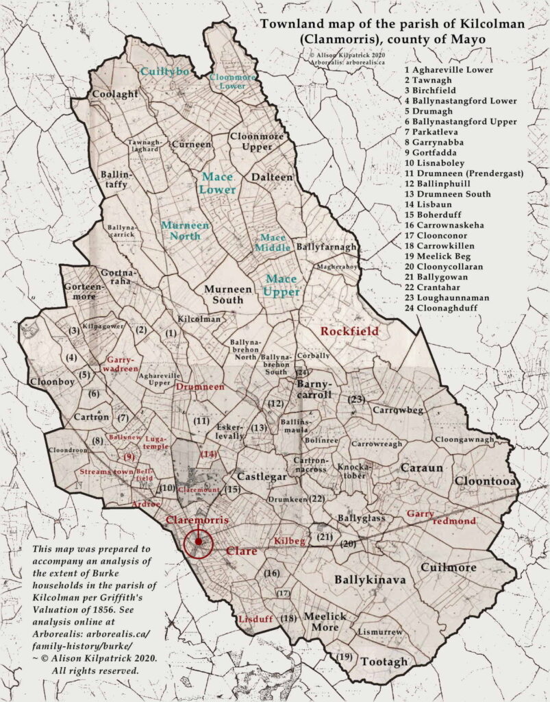
Home > Family history > Ireland > Burke of Kilcolman > Townland map, Kilcolman (Clanmorris) in Griffith’s Valuation, 1856
 askaboutireland.ie (accessed 2020).
Source of 2nd Ordnance Survey:—Griffith, Richard. General Valuation of Rateable Property in Ireland. “County of Mayo. Valuation of the Several Tenements in the Union of Claremorris.” Citing extracts for the parish of Kilcolman. Dublin: Alex. Thom and Sons, 1856.
End notes :
Source citation for this page: — Kilpatrick, Alison. “Map of the Parish of Kilcolman (Clanmorris), County Mayo, 1856″. Featuring an enlarged townland map, highlighting Burke households distributed across the parish. Prepared by Alison Kilpatrick ©2023. Adapted from the digital image online at AskAboutIreland (accessed 5th Jan. 2021). Published to Arborealis, online at arborealis.ca/family-history/irish/burke/map-kilcolman-enlarged/, accessed [insert date].
All rights reserved. Alison Kilpatrick ©2023.
Added 8th Oct. 2023; edited 27th Dec. 2023.