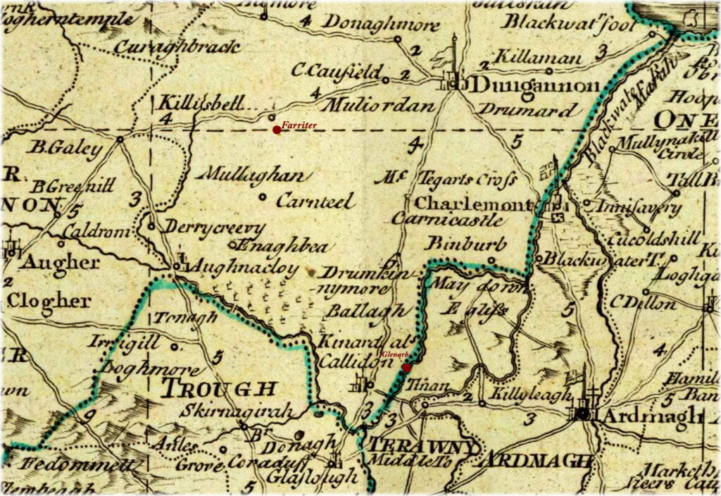
Source: A map of the Kingdom of Ireland (part), by John Rocque (1790). Edited by Alison Kilpatrick (2024) to highlight the locations of Farriter townland, near Killeeshil in the top left quadrant of this image, and of Glenarb townland, which lies near the town of Caledon, formerly known as Kinard or Kinnaird. This map show these locations relative to other towns such as Glasslough in county Monaghan, Aughnacloy, Castlecaulfeild (here, written as C. Caufield), Dungannon, Charlemont, Blackwatertown, and Benburb in the county of Tyrone, and the city of Armagh.
End notes :
Source citation for this page: Arborealis. “Map of Farriter in the parish of Killeeshil, county Tyrone (1790) (part), by John Rocque.” Published to Arborealis, online at arborealis.ca/family-history/irish/ferguson/map-farriter/, accessed [insert date].