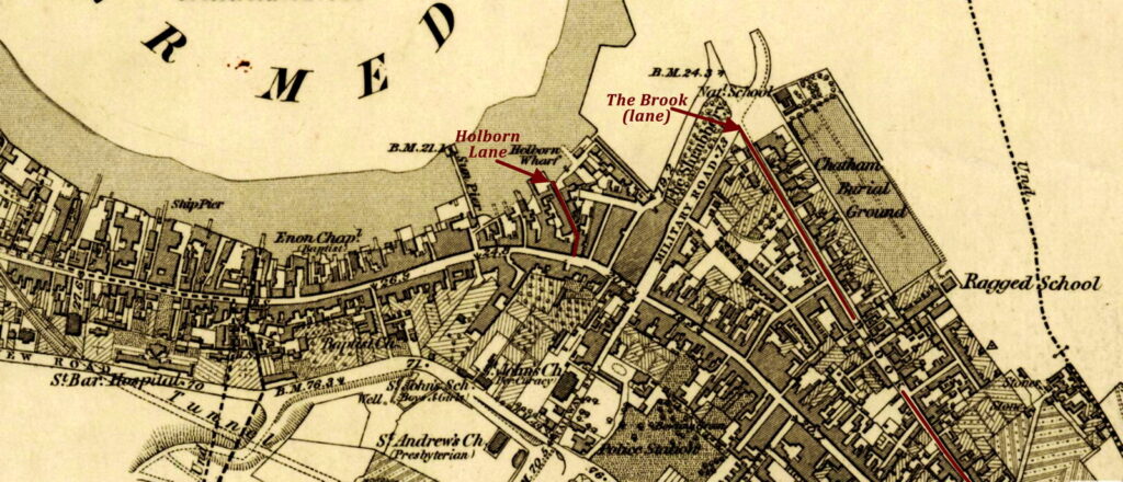
Chatham, on the Medway (c.1863); highlighting the location of Holborn Lane. Source: Ordnance Survey (UK). Kent XIX (includes: Chatham; Frindsbury Extra; Rochester). Surveyed 1863–1865, published 1869. Digital image hosted online by the National Library of Scotland nls.uk (accessed 17th Jan. 2021). Edited by Alison Kilpatrick (2021) by cropping map to that part of the town of Chatham near Holborn Wharf, and to highlight the location of Holborn Lane.
End notes :
Source citation for this page:Kilpatrick, Alison. “Map of Chatham on the Medway c.1863.” Published to Arborealis, online at arborealis.ca/family-history/irish/mcdonnell/map-chatham-1863/, 28th Dec. 2023; accessed [insert date].